")
")
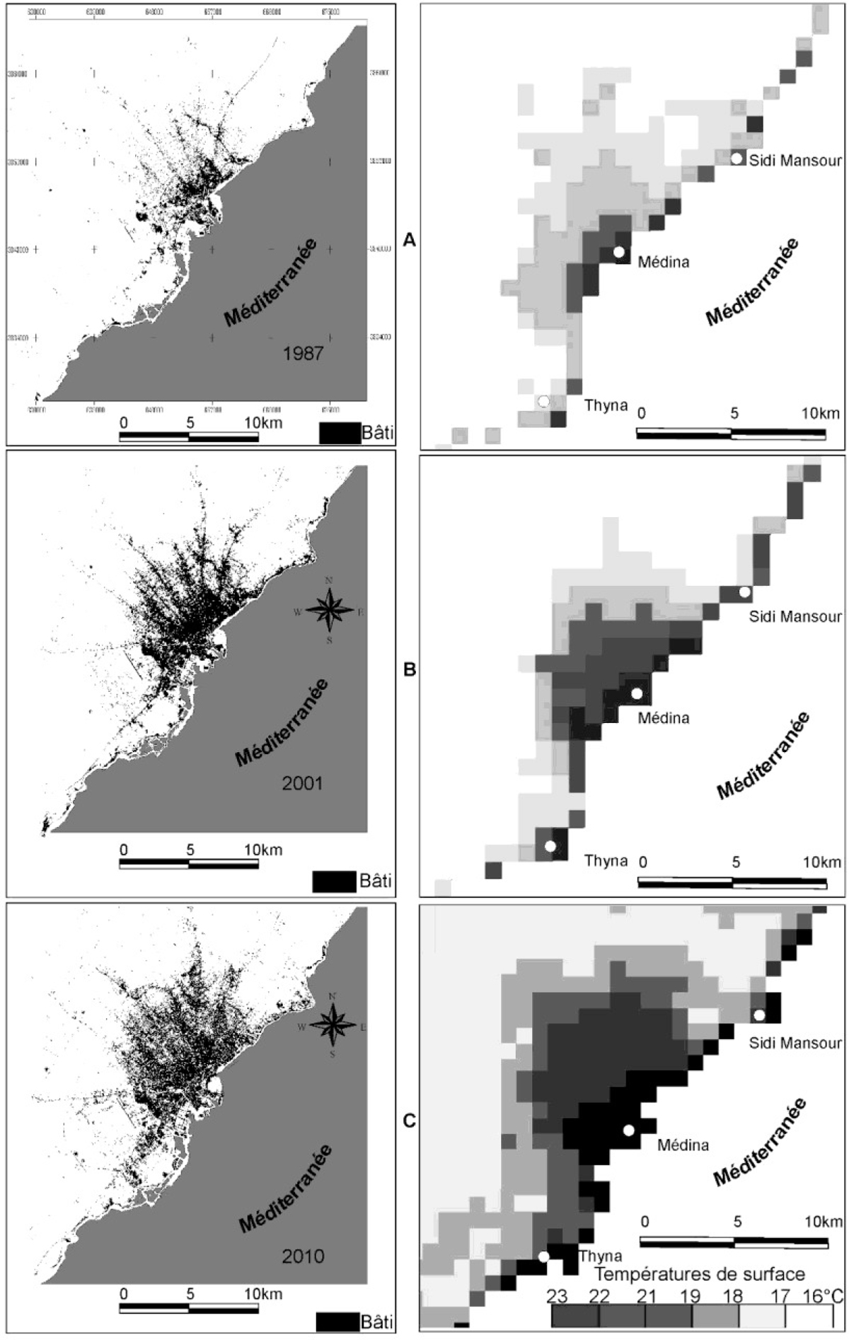
Figure 5
Download original image
Répartition spatiale des surfaces bâties et des températures de surface dans l’agglomération de Sfax observées le 29 juillet 1987 (A), le 27 juillet 2001 (B) et le 19 juillet 2010 (C) ; températures de surfaces déduites à partir d’images NOAA-AVHRR prises vers 01 h TU et surfaces bâties obtenues à partir d’images Landsat TM. Spatial distribution of built areas and surface temperatures in Greater Sfax observed in July 29, 1987 (A), July 27, 2001 (B) and July 19, 2010 (C); surface temperature derived from NOAA-AVHRR images taken around 01 am and surfaces built obtained from Landsat TM.
Current usage metrics show cumulative count of Article Views (full-text article views including HTML views, PDF and ePub downloads, according to the available data) and Abstracts Views on Vision4Press platform.
Data correspond to usage on the plateform after 2015. The current usage metrics is available 48-96 hours after online publication and is updated daily on week days.
Initial download of the metrics may take a while.