")
")
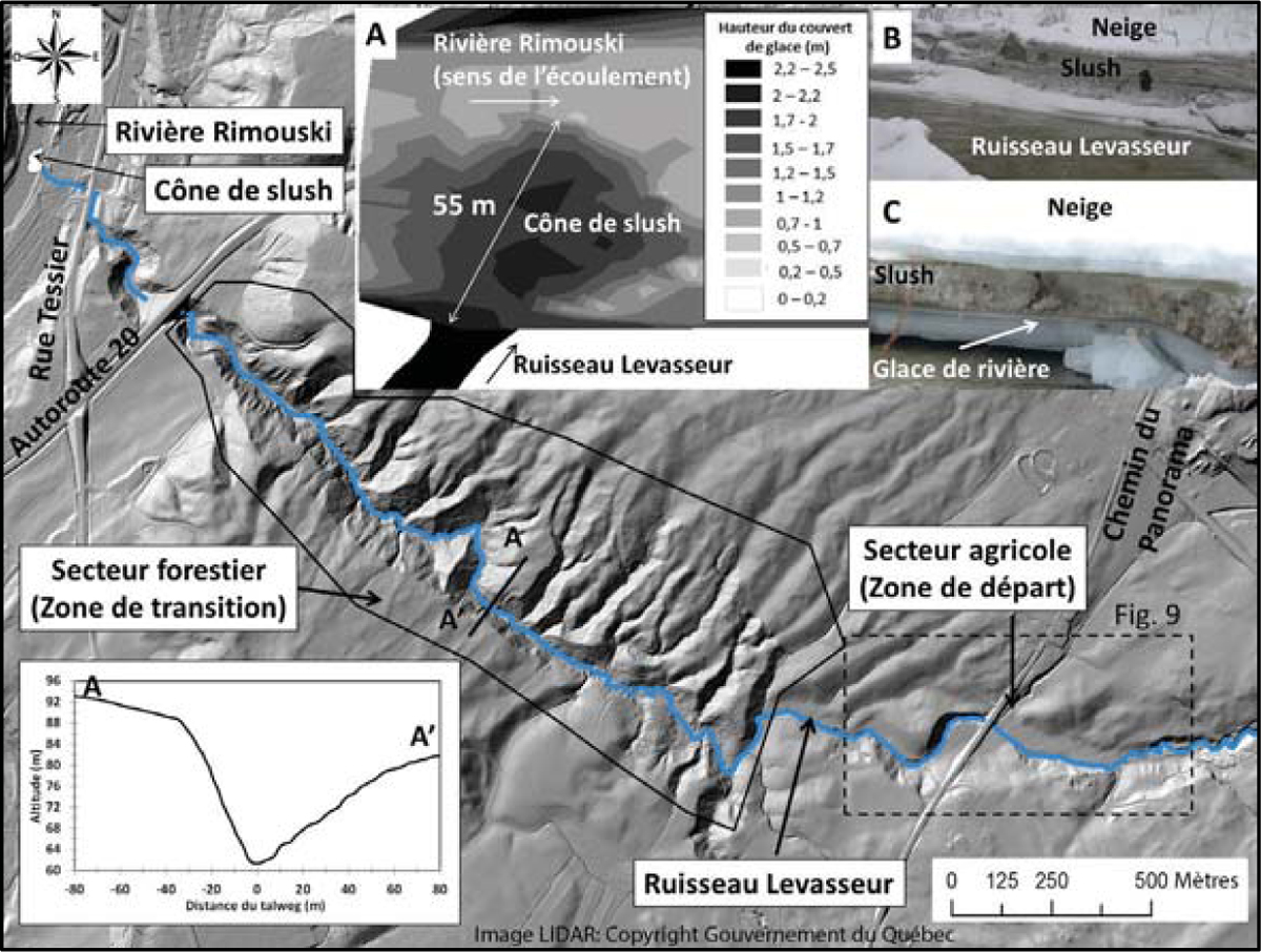
Figure 8
Download original image
Relevé LIDAR du Ruisseau Levasseur. (A) Topographie du cône de slush qui s’est accumulé sur le couvert de glace de la rivière Rimouski. (B) Dépôt de slush en rive gauche du ruisseau 12 m en amont de l’embouchure du ruisseau. (C) Dépôt de slush sur le couvert de glace de la rivière Rimouski. LIDAR : Gouvernement du Québec. LIDAR survey of Ruisseau Levasseur. (A) Topography of the slush cone that has accumulated on the ice cover of the Rimouski River. (B) Deposit of slush on the left bank of the stream 12 m upstream of the mouth of the creek. (C) Slush deposit on the ice cover of the Rimouski River.
Current usage metrics show cumulative count of Article Views (full-text article views including HTML views, PDF and ePub downloads, according to the available data) and Abstracts Views on Vision4Press platform.
Data correspond to usage on the plateform after 2015. The current usage metrics is available 48-96 hours after online publication and is updated daily on week days.
Initial download of the metrics may take a while.