")
")
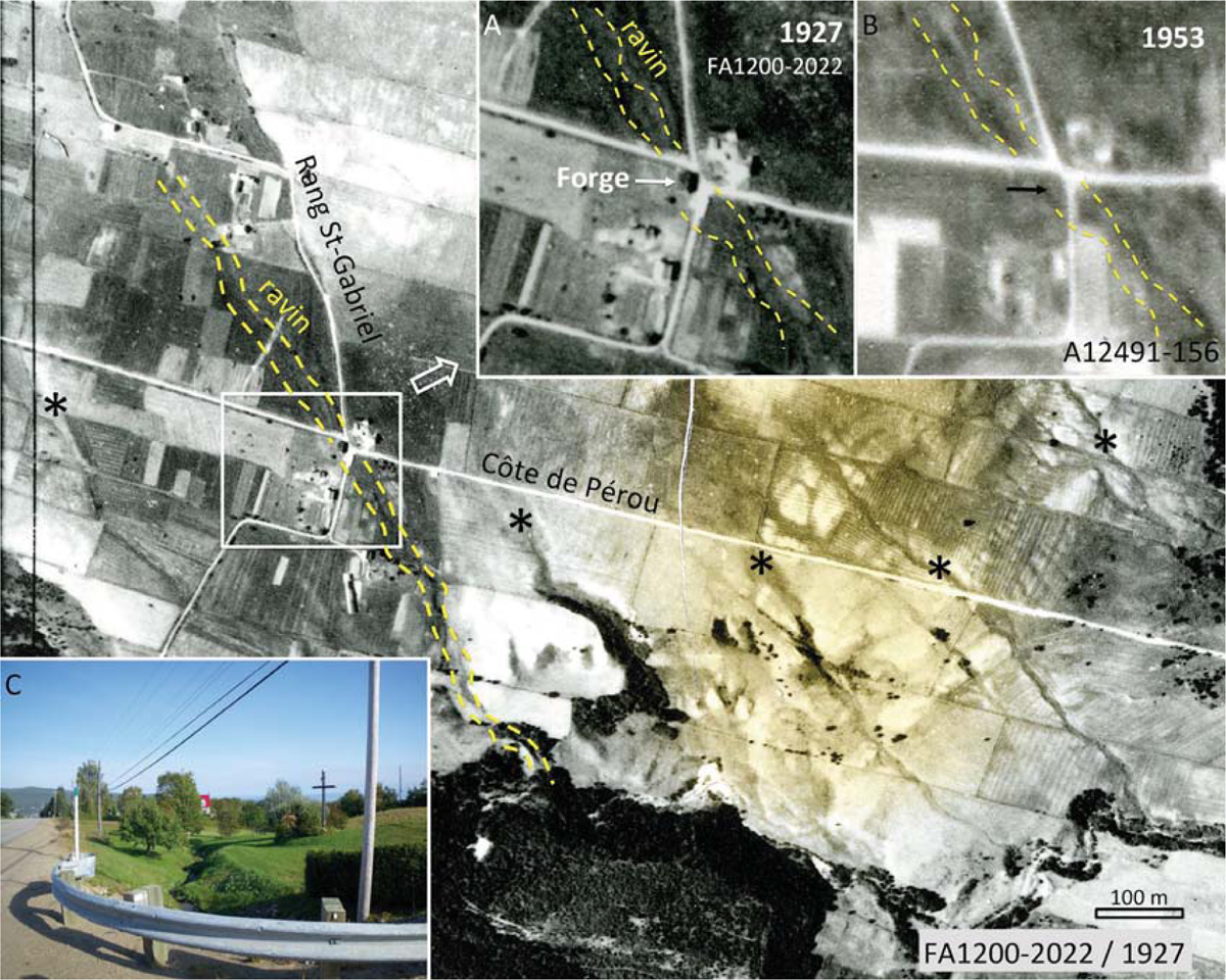
Figure 16
Download original image
Baie-Saint-Paul – Localisation de la forge déplacée par la coulée de slush du 12 mars 1936 à l’intersection du chemin de la Côte de Pérou et du Rang St-Gabriel. Bien visible sur la photo de 1927 (A), la forge a disparu sur la photo de 1953 (B). Le ravin emprunté par la coulée de slush est indiqué par les lignes en tirets jaunes. On devine plusieurs ravins similaires sur la grande photo (astérisques noirs). (C) Le ravin près du site de l’ancienne forge (détruite depuis). Baie-Saint-Paul - Location of the forge displaced by the slush flow of 12 March 1936 at the intersection of Côte de Pérou and St-Gabriel Rd. Visible in the photo of 1927 (A), the forge disappeared in the photo of 1953 (B). The ravine taken by the slush flow is indicated by the dashed lines. We can guess several similar ravines on the large photo (black asterisks). (C) The ravine near the old forge.
Current usage metrics show cumulative count of Article Views (full-text article views including HTML views, PDF and ePub downloads, according to the available data) and Abstracts Views on Vision4Press platform.
Data correspond to usage on the plateform after 2015. The current usage metrics is available 48-96 hours after online publication and is updated daily on week days.
Initial download of the metrics may take a while.