")
")
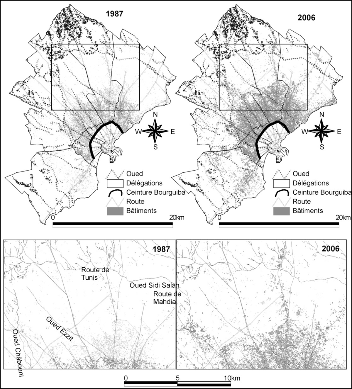
Figure 11
Download original image
Bâti et réseau hydrographique dans la partie non protégée par le canal de ceinture (canal du km 4) du Grand Sfax en 1987 et 2006 (bâti déterminé à partir des photographies aériennes de 1987 et d’une couverture Ikonos datée de 2006; cours d’eau tracés à partir des cartes topographiques de 1992 au 1/25000). Built area and river system in the unprotected part of Grand Sfax in 1987 and 2006 (built areas determined from the aerial photos of 1987 and Ikonos image of 2006. Wadi are plotted from topographic maps of 1992 with 1/25000 scale).
Current usage metrics show cumulative count of Article Views (full-text article views including HTML views, PDF and ePub downloads, according to the available data) and Abstracts Views on Vision4Press platform.
Data correspond to usage on the plateform after 2015. The current usage metrics is available 48-96 hours after online publication and is updated daily on week days.
Initial download of the metrics may take a while.