")
")
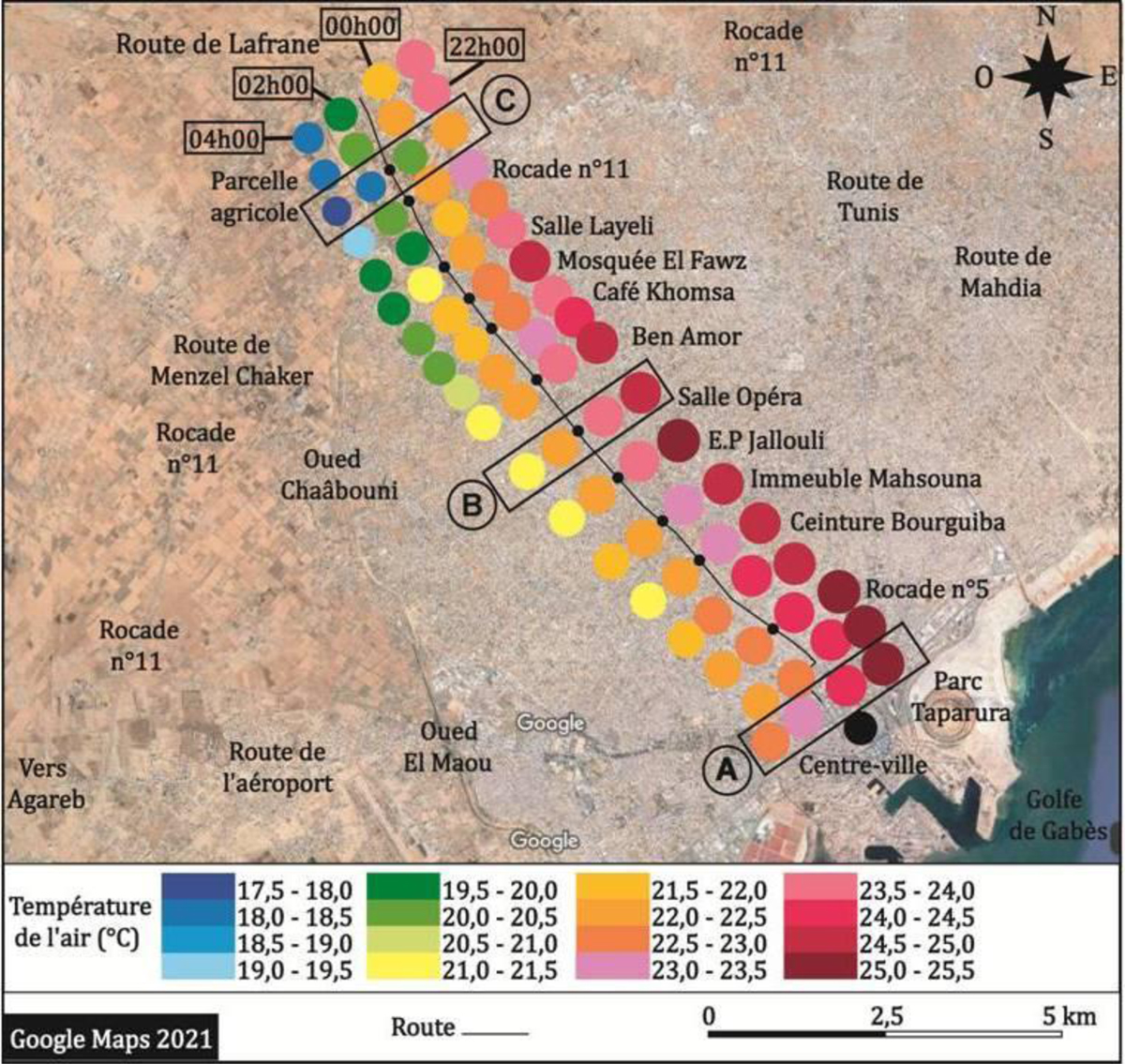
Figure 2
Download original image
Évolution spatiotemporelle des températures de l’air en phase nocturne dans l’agglomération de Sfax : d’après les mesures itinérantes effectuées la nuit du 24 juin 2020 entre 22h et 4h du matin (heure locale), le long du transect A (cf. figure 1) : (A) partie centrale, bâti très dense, (B) zone moins dense et (C) zone périphérique dégagée. Fond: image Google Maps 2021. Spatiotemporal evolution of air temperatures in the night phase in the agglomeration of Sfax: according to mobile survey carried out on the night of June 24, 2020 between 10 p.m. and 4 a.m. (local time), along transect A (cf. figure 1 ): (A) central part, very dense built-up area, (B) less dense area and (C) cleared peripheral area. Background: Google Maps 2021 image.
Current usage metrics show cumulative count of Article Views (full-text article views including HTML views, PDF and ePub downloads, according to the available data) and Abstracts Views on Vision4Press platform.
Data correspond to usage on the plateform after 2015. The current usage metrics is available 48-96 hours after online publication and is updated daily on week days.
Initial download of the metrics may take a while.