")
")
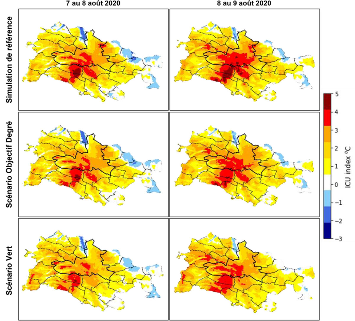
Figure 2
Download original image
Carte des îlots de chaleur urbains simulés avec TEB/SURFEX sur le territoire de Dijon Métropole. Les ICU sont calculés par rapport à une référence rurale fixe située à l’est de la métropole selon la formule (T°C ville) – (T°C référence rurale). Map of urban heat islands simulated with TEB/SURFEX in the Dijon Métropole area. UHI are calculated in relation to a fixed rural reference located to the east of the metropolitan area using the formula (city temperature) - (rural reference temperature).
Current usage metrics show cumulative count of Article Views (full-text article views including HTML views, PDF and ePub downloads, according to the available data) and Abstracts Views on Vision4Press platform.
Data correspond to usage on the plateform after 2015. The current usage metrics is available 48-96 hours after online publication and is updated daily on week days.
Initial download of the metrics may take a while.