")
")
Figure 12
Download original image
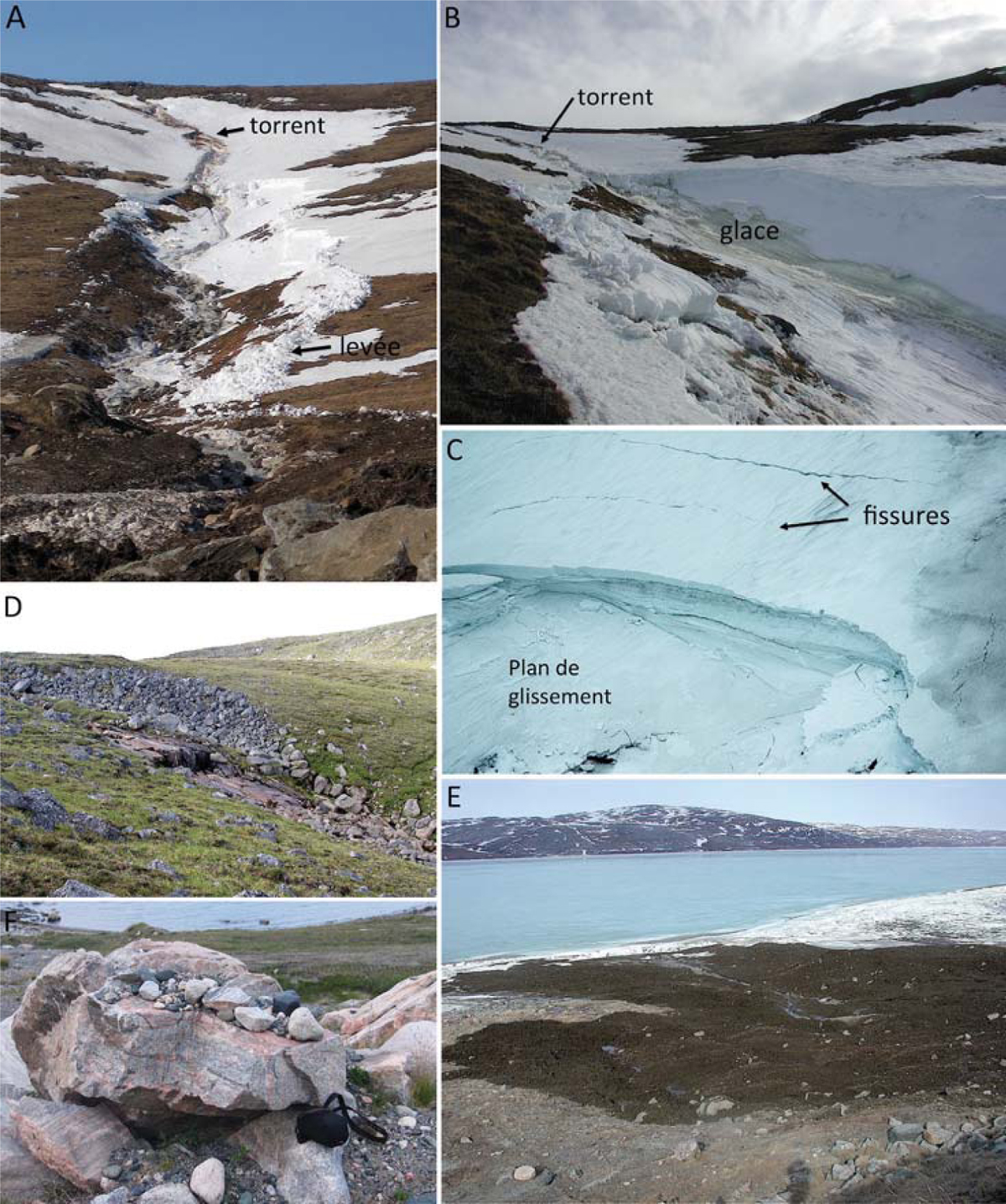
Deception Bay – (A) Zone de départ de la coulée de 2011 à environ 30 m sous le rebord du plateau. La zone de dépôt commence sous la rupture de pente soulignée par un gros rocher à gauche. (B) Zone de départ en amphithéâtre de la coulée de 2011. (C) Zone de départ en amphithéâtre de la coulée de 2005 avec deux fissures de tension juste au-dessus. (D) Zone de départ des coulées photographiée à la fin de l’été 2005. Le ravin s’est incisé dans le till (blocs) jusqu’au roc. (E) Langue de débris accumulés près de la berge du fjord par la coulée de 2011. (F) Chaos de blocs empilés déposés par la coulée de 2005. Deception Bay - (A) Starting area of 2011 flow about 30 m below the edge of the plateau. The deposition area starts at break of slope underlined by a large rock on the left. (B) Starting area in amphitheater of the flow of 2011. (C) Starting area in amphitheater of the flow of 2005 with two tension cracks just above. (D) Starting area of flow photographed at the end of summer 2005. (E) Tongue of debris accumulated near the bank of the fjord by the flow of 2011. (F) Stacked block chaos deposited by the 2005 flow.
Current usage metrics show cumulative count of Article Views (full-text article views including HTML views, PDF and ePub downloads, according to the available data) and Abstracts Views on Vision4Press platform.
Data correspond to usage on the plateform after 2015. The current usage metrics is available 48-96 hours after online publication and is updated daily on week days.
Initial download of the metrics may take a while.