")
")
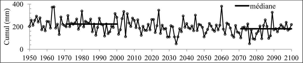
Figure 6
Download original image
Evolution des cumuls de précipitations d’été (JJA) désagrégés à échelle fine par la méthode DSCLIM à partir de la simulation ARPEGE-Climat V4 forcée A2. Les valeurs médianes en période de référence (1971-2000) et en période de projection (2071-2100) sont également indiquées. Point de grille SAFRAN de coordonnées 49.145°N/5.351°E situé au centre du bassin de la Meuse française (cf. figure 1). Statistical downscaled summer (JJA) rainfall amounts (application of the DSCLIM method to the ARPEGE-Climat model simulation forced by the A2 emission scenario). Coordinates of the SAFRAN grid point are 49.145°N/5.351°E (see figure 1).
Current usage metrics show cumulative count of Article Views (full-text article views including HTML views, PDF and ePub downloads, according to the available data) and Abstracts Views on Vision4Press platform.
Data correspond to usage on the plateform after 2015. The current usage metrics is available 48-96 hours after online publication and is updated daily on week days.
Initial download of the metrics may take a while.