")
")
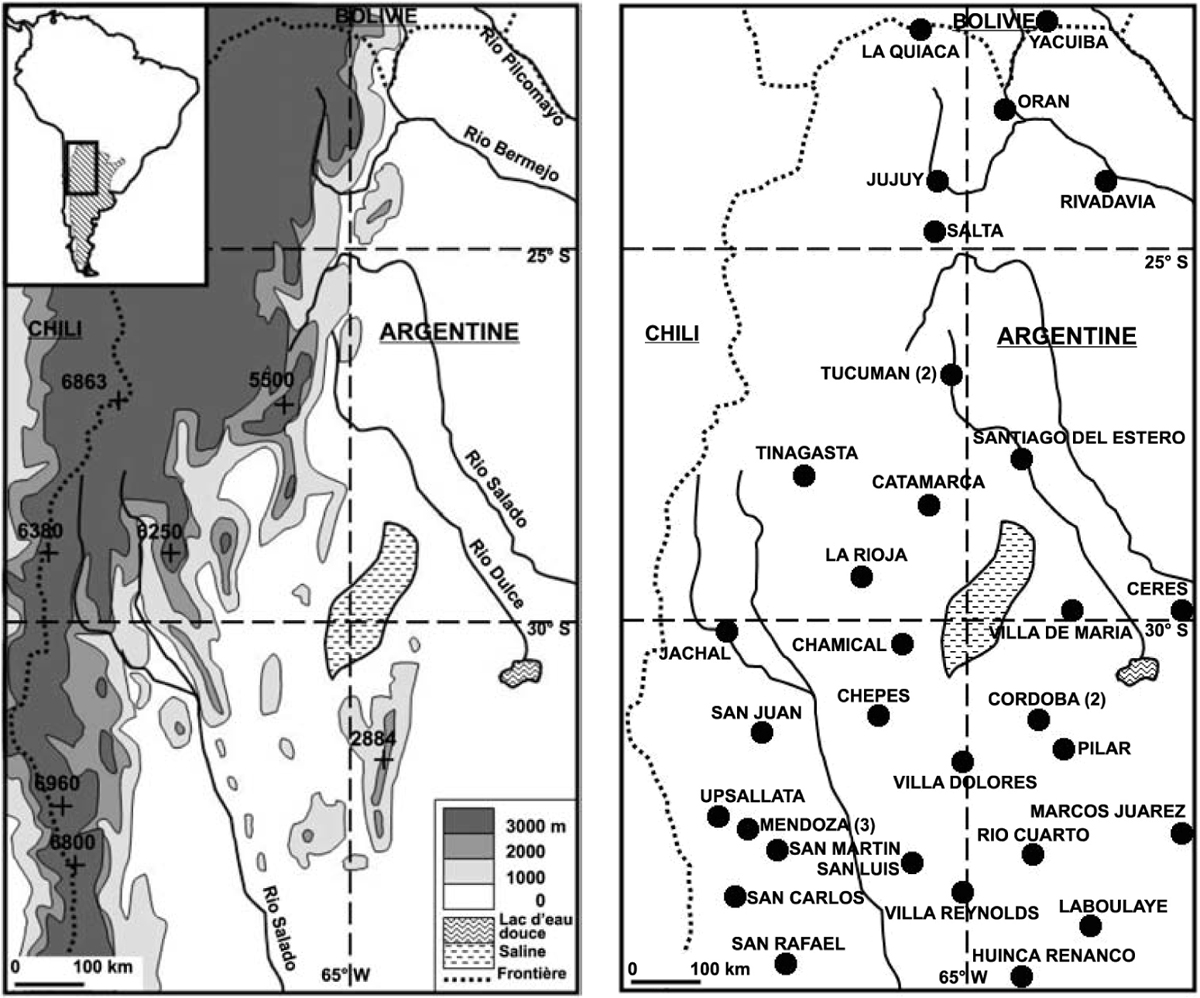
Figure 1
Download original image
Cartes de présentation de l’espace étudié. Maps of the studied area. A gauche : Relief et principaux cours d’eau du nord-ouest de l’Argentine. Localisation du Nord-Ouest argentin en Amérique du Sud (cadre en haut à gauche). Left : Relief and hydrography of North-West Argentina and location of the studied area in South America (box). A droite : Localisation des stations des stations de référence (au moins deux stations à proximité d’une même agglomération : nombre de stations indiqué à Córdoba, Mendoza et Tucumán). Right : Location of the reference stations (at least two stations close to the same city : the number of stations is mentioned at Córdoba, Mendoza et Tucumán).
Current usage metrics show cumulative count of Article Views (full-text article views including HTML views, PDF and ePub downloads, according to the available data) and Abstracts Views on Vision4Press platform.
Data correspond to usage on the plateform after 2015. The current usage metrics is available 48-96 hours after online publication and is updated daily on week days.
Initial download of the metrics may take a while.